Maps
Here are the current maps of the lands in Nebulum. Please excuse my poor cartographic skills. These have all been hand-drawn on paper, then scanned into my computer where I have done extensive editing using Microsoft Paint. Eventually, I would like to have them as vector graphics, but I don't see that happening. As it is, there are some discrepancies between these maps and the story.
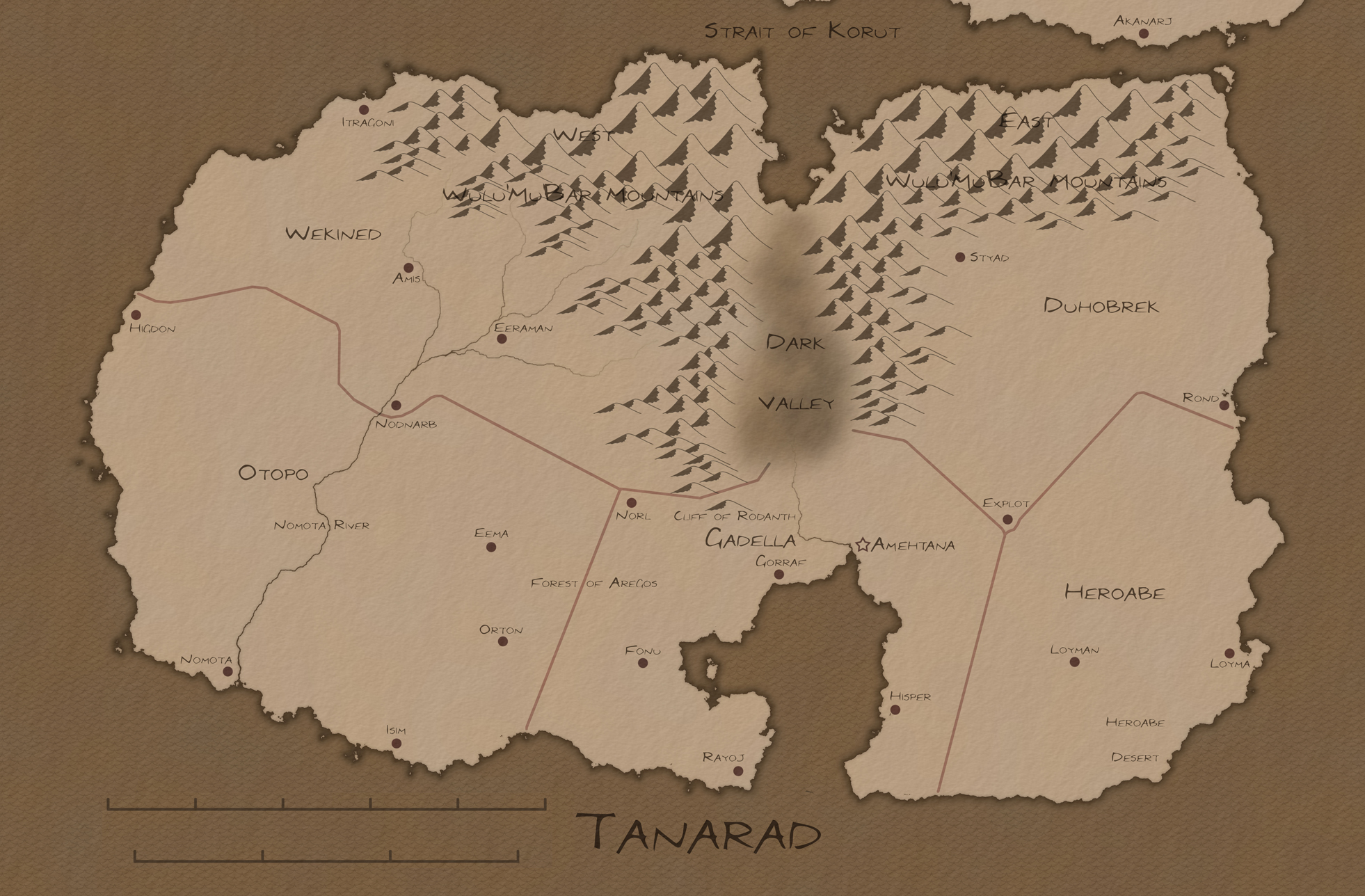
Tanarad
The primary issues with this map is the mountains really should go along the entire length of the Dark Valley. The mountains are also missing their name: Wulu'Mu'Bar Mountains. Also, this map does not include the ruins of Latan which are located halfway between Higdon and Nomota. Finally, there is a large swamp in the Dark Valley which is the only natural habitat for the black turtles.
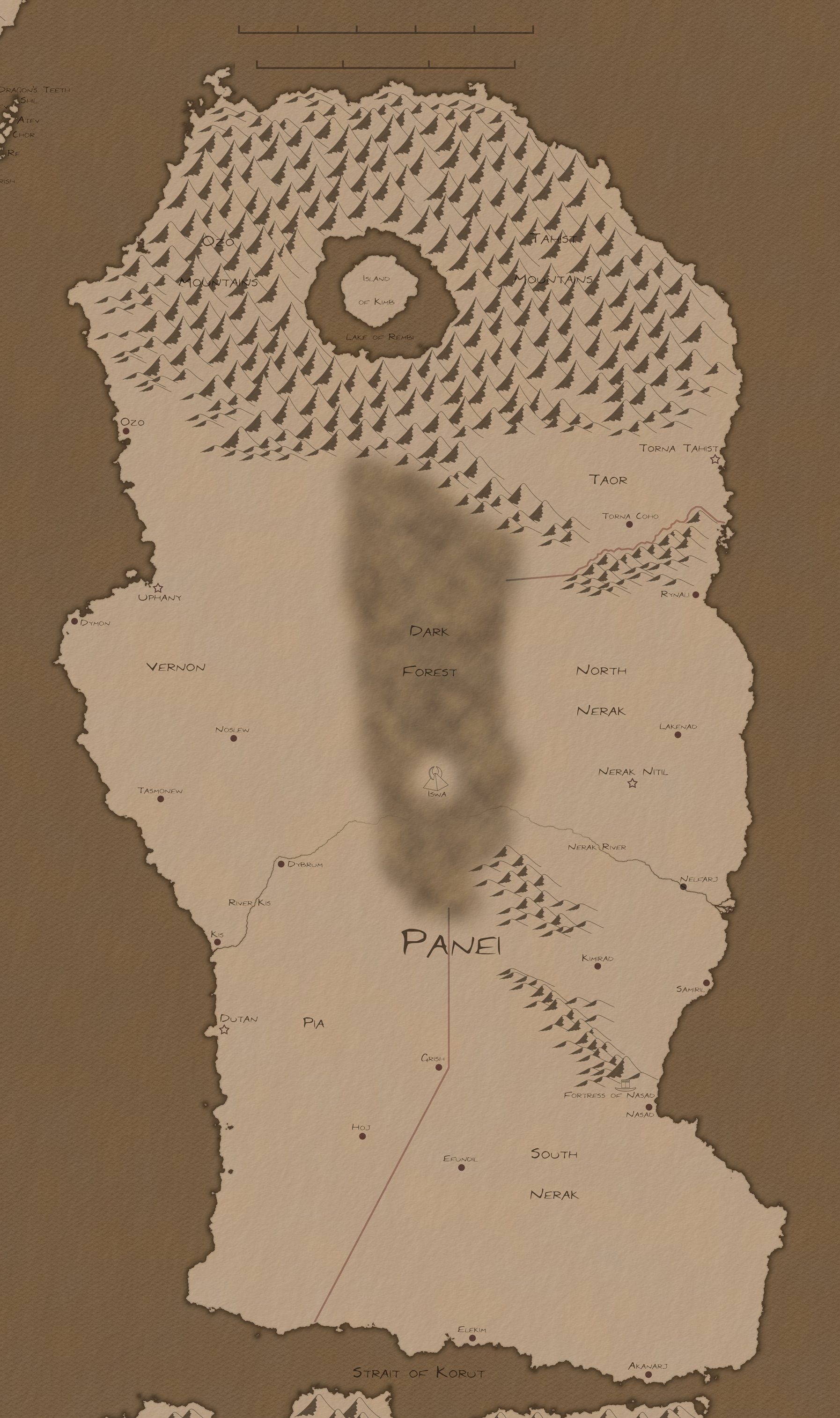
Panei
This map is missing the names of the northern mountains. The Ozo Mountains are those to the west and the Tahist Mountains are those to the east. The map also does not show the route of the great tunnel leading from the Fortress of Nasad to the Island of Kimb.
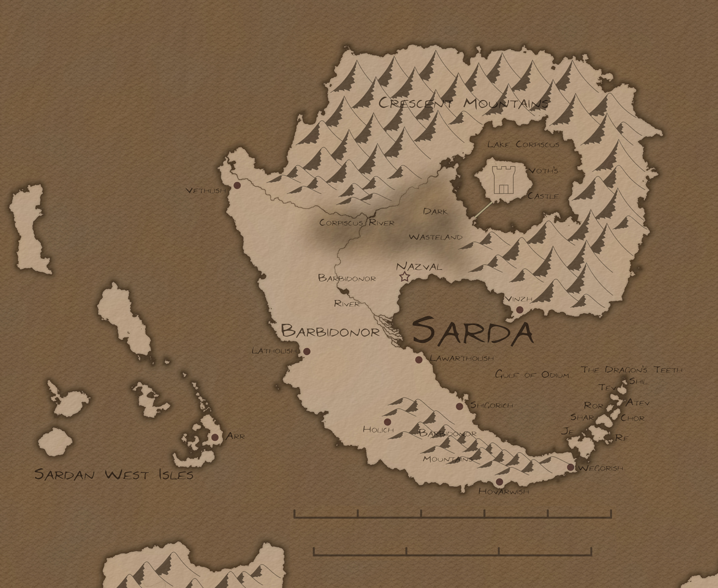
Sarda
It should be noted that Voth's castle located in Lake Corpiscus is actually on a mountain jutting from the lake. It is not drawn to scale as the rest of the map is.
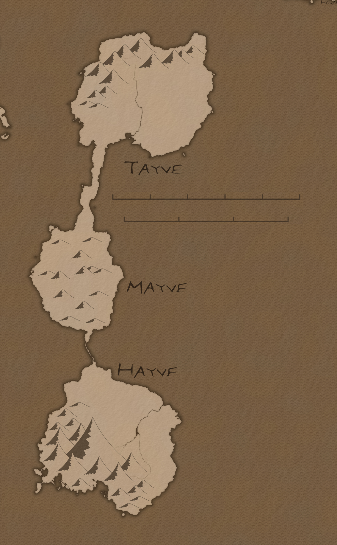
Hayve, Mayve, and Tayve
This is actually an early version of these three lands. One of the most notable discrepancies is that the northern part of Tayve is actually a high plateau instead of a range of mountains.
Etnyben
Under Development!


